Skip to content

Projects

Sketch of the road leading up to Duke Chapel with written annotations describing the landscape along the road.

World Building at Duke in an Emerging Durham: 1924-1932

%%tb-image-alt-text%%

World Building at Duke in an Emerging Durham: 1924-1932

Project Lead(s): Robert Buerglener,

Victoria Szabo,

Hannah L. Jacobs,

Edward Triplett

20232025

This project is part of the 2023-2024 Bass Connections Duke’s Centennial popup theme.

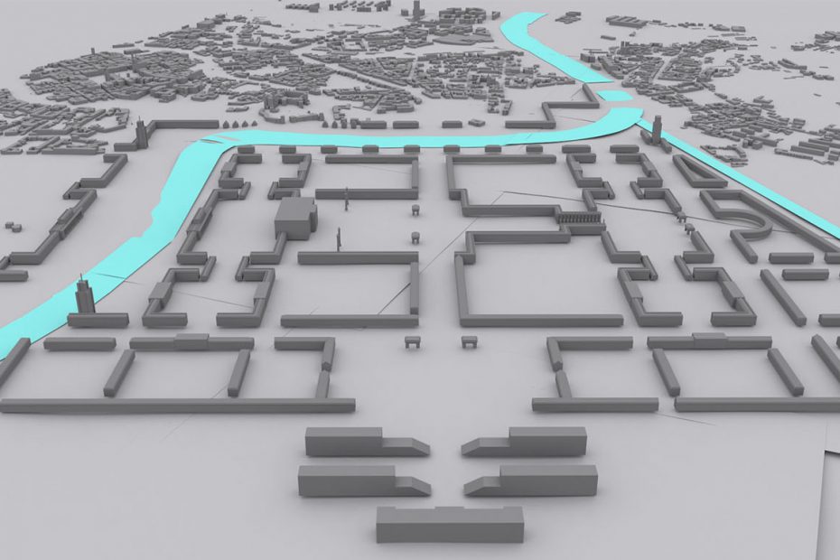
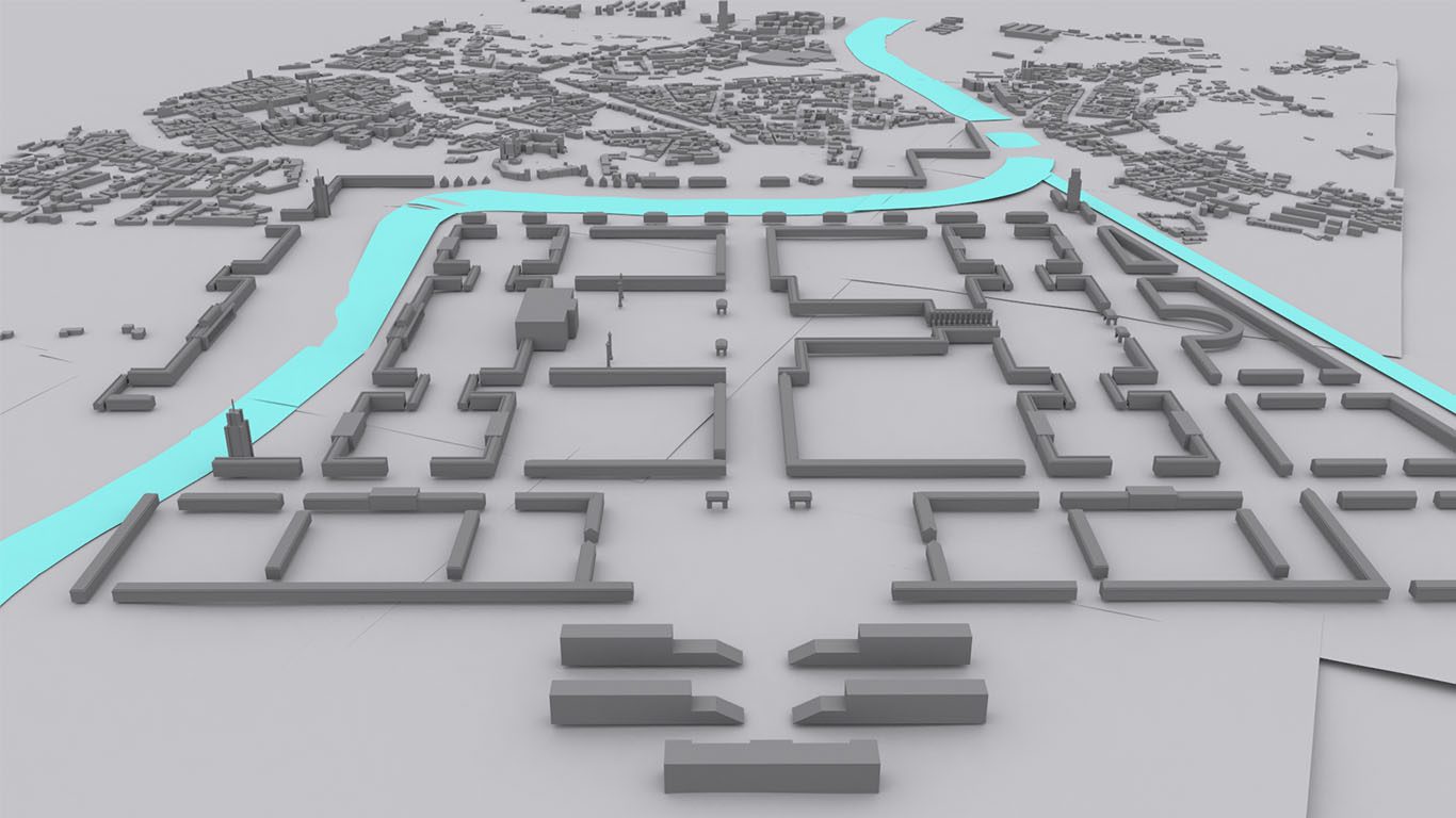
The establishment of the Duke Endowment in 1924 enabled the massive building campaign that gave us the Duke University we know today. That building history has been researched in its essential parts. However, two aspects remain under-investigated: how the building process itself developed from a series of plans that included competing concepts of landscape, social organization and place; and how that building process intersected with and impacted local individuals, communities and institutions. 

A deep dive into the choices surrounding the building of Duke and its relationship to Durham will help us consider questions about the broader integration of the university and the city. By taking the building of Duke’s campus as a focal point in the history of the city, we can investigate how the “world building” efforts of Duke’s leaders intervened in the existing lifeworld, landscapes and built environments of Durham and its inhabitants in the 1920s. 

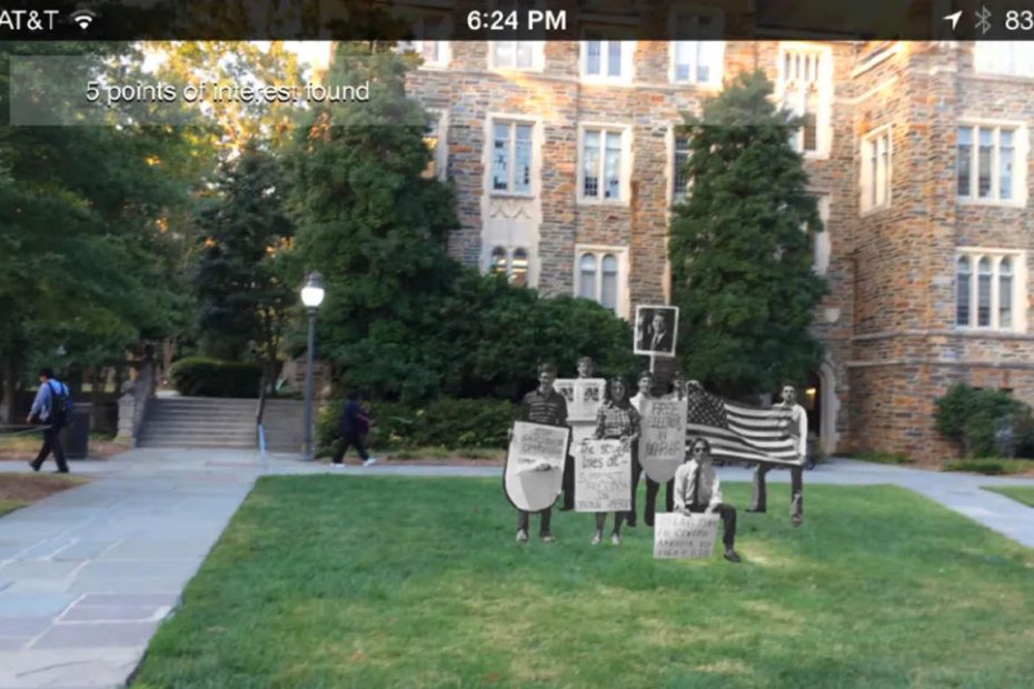
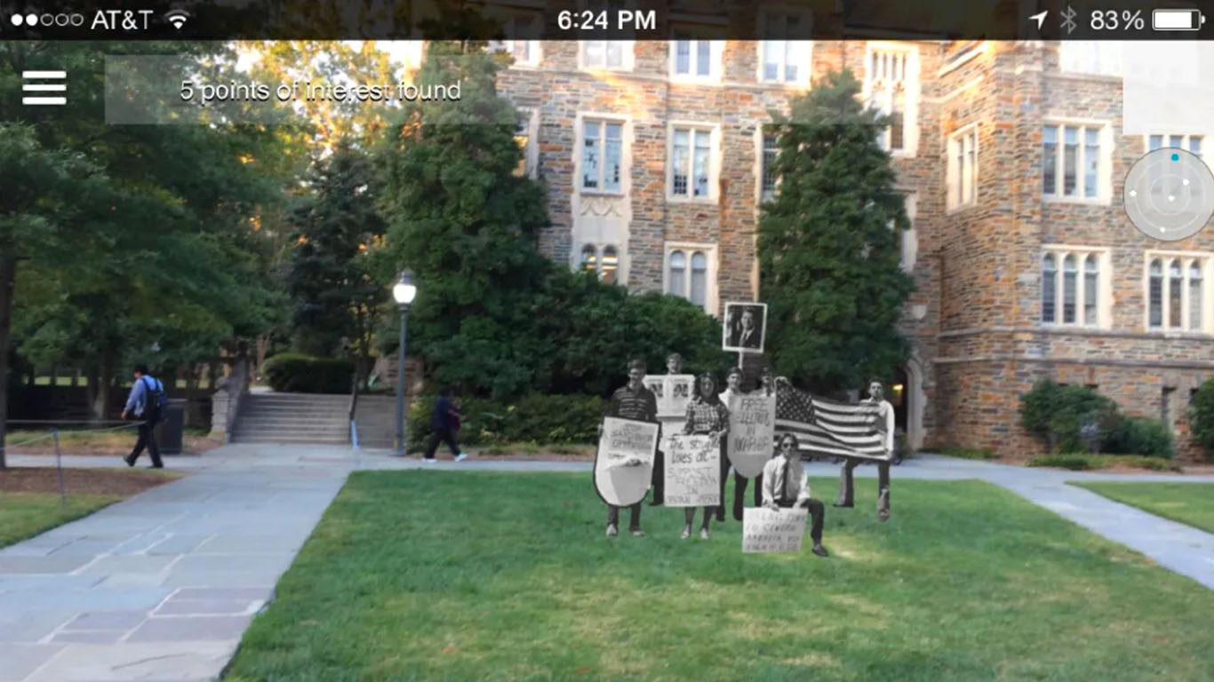
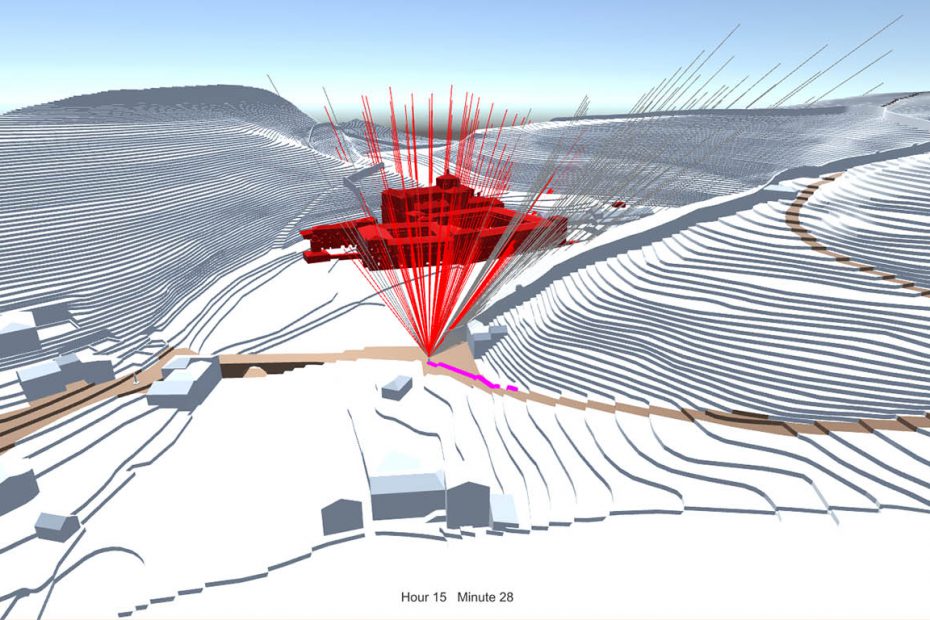
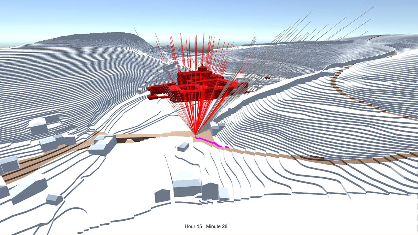
This project examines not only how built environments result from social, economic and political conditions, but also, crucially, how they contribute to the development of these very conditions. Using Duke University and its construction in Durham between 1924 and 1932 as a model, team members will explore how construction and destruction are forms of world building, both physically and conceptually understood. 

Giving equal attention to the cultural and social development of Durham and Duke, team members will examine building at four different scales: Duke’s physical and built environment, the world of Duke in Durham, the broader context of Durham in the 1920s, and the projection of the university’s image (as well as the city’s image) to the nation and globally. Using these scales, the team will investigate connections as well as ruptures between the university and the city as their landscapes changed and the project of building Duke intervened in the life of the city and its inhabitants. 

Key themes to be explored include: the transformation of the landscape and the founding myth of the “university in the forest”; the flow of materials (e.g., bricks, stone, cement) through the local and regional building economy; the lived experiences, built environments and lifeworlds of the people who lived in the city in the decade around Duke’s inception; and the ways in which Duke’s and Durham’s roles in the global economy were rooted in early twentieth-century world building.

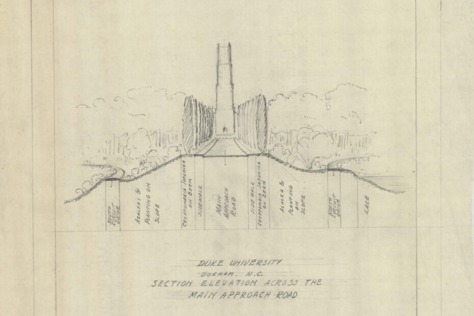
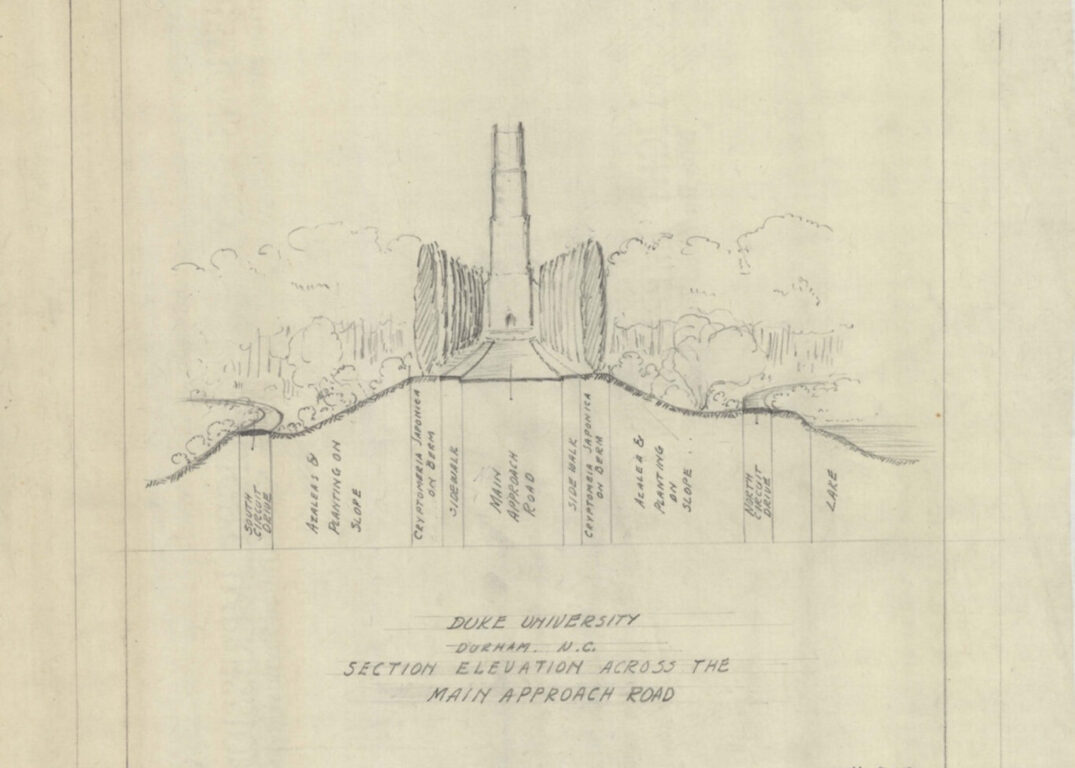
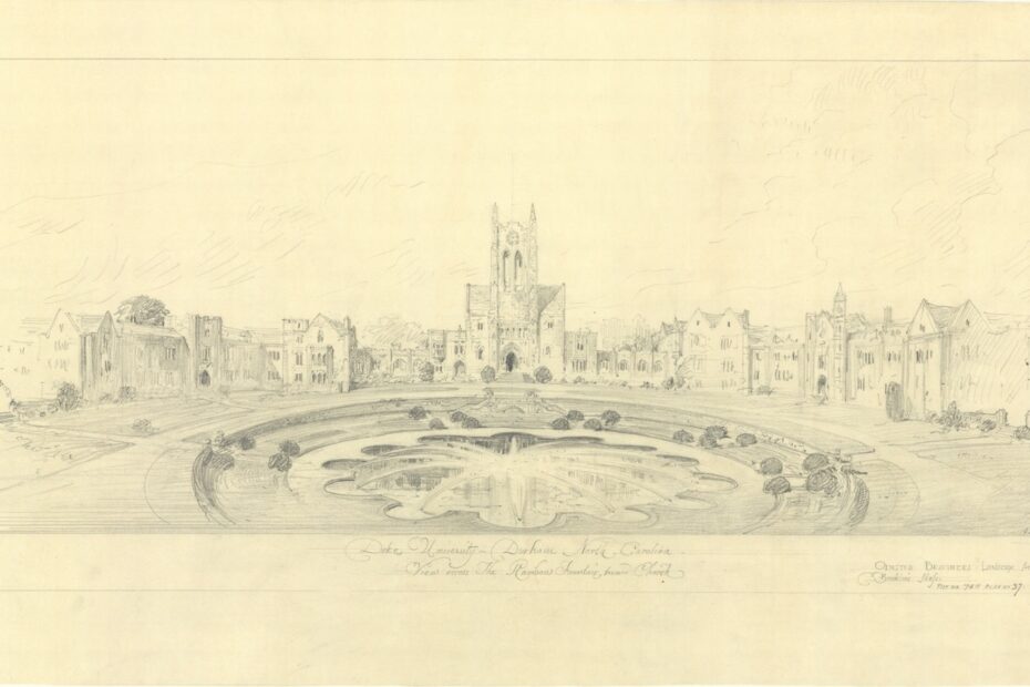
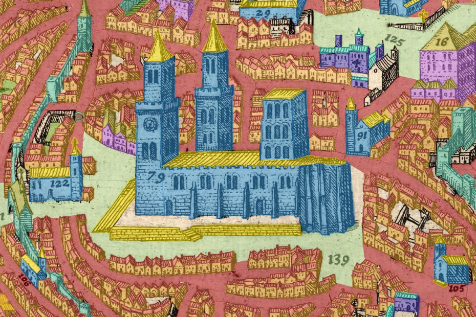
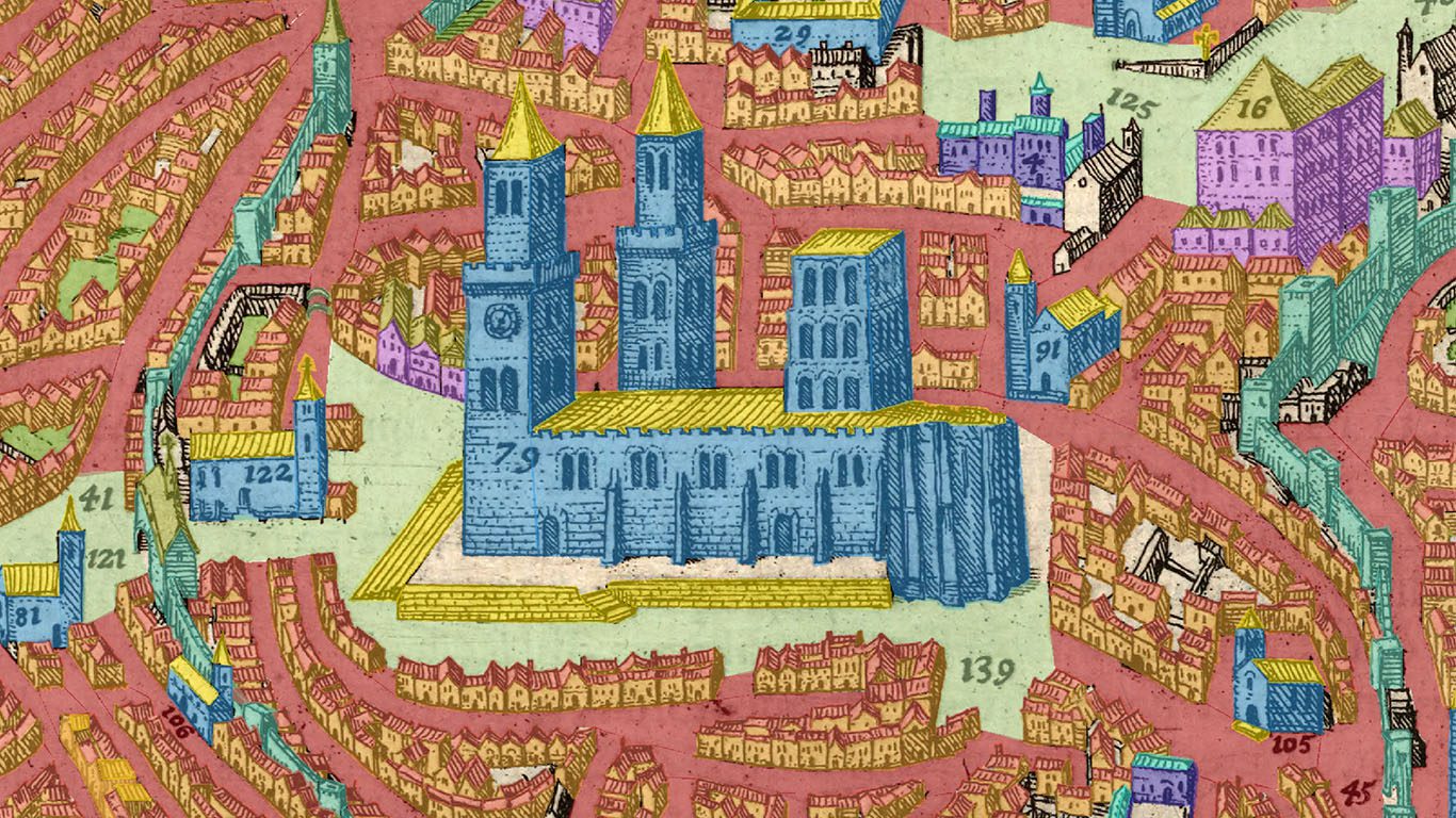
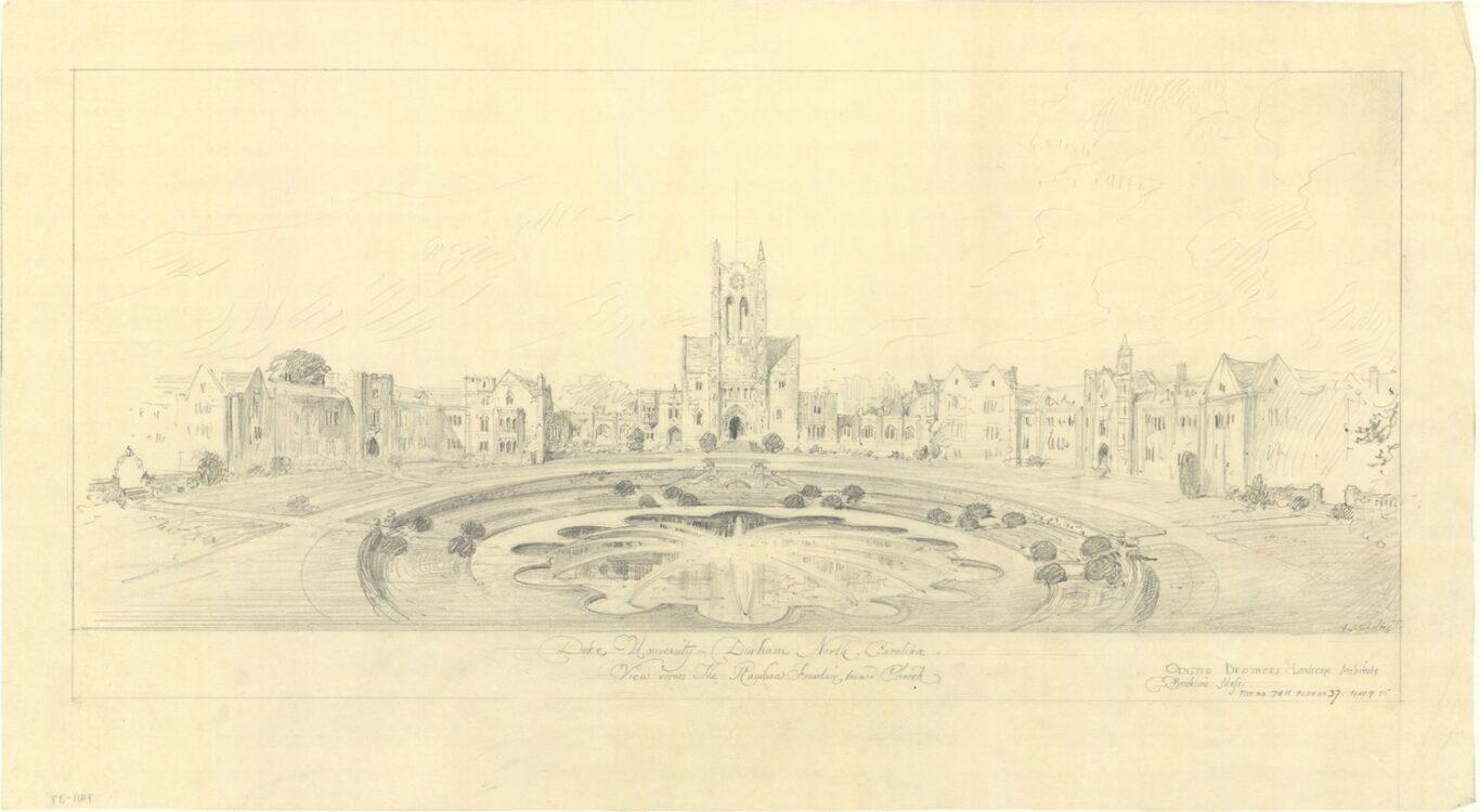
Image Credit: Olmsted Brothers Landscape Architecture Firm Archive

Current Collaborators

Trudi Abel
Carson Holloway
Paul Jaskot

Related Projects

Building Duke
Building the Olmsted Record
Digital Durham

Pencil sketch showing gothic buildings with a chapel at the center and a large fountain in the foreground.

Building the Olmsted Record: Duke University’s Landscape Architecture

%%tb-image-alt-text%%

Building the Olmsted Record: Duke University’s Landscape Architecture

2018

Building the Olmsted Record: Duke University’s Landscape Architecture documents the history of Duke’s landscape architecture from its early conception in the 1920s. The project has three main goals: first, to research and create a digital repository of documentary evidence, visual and written, about the conception of Duke and its cultivated and natural landscape; second, to combine and structure the wealth of documentation from the Olmsted Archives in Massachusetts along with other records in the Duke University Archives and the Library of Congress into a sharable platform within Airtable; and third, to interpret these documents and generate historical narratives in ArcGIS StoryMaps in addition to traditional scholarly essays.

As a subproject of Building Duke, Building the Olmsted Record expands our knowledge and understandings of Duke’s physical environment and re-establishes the Olmsted firm’s fundamental role in the original conception of the campus. Select people, including Robert Lee Flowers, A.C. Lee, and Percival Gallagher, working in tandem with institutional ambitions, collectively informed the present-day shape of Duke’s intertwined cultivated landscape and architectural elements. The stories of these central protagonists and the Olmsted Firm, with celebrated projects like New York City’s Central Park and closer to home Vanderbilt’s Biltmore Mansion, have become imprinted within the two campuses and specific spaces that collectively form Duke University.

Featured Image: Unrealized Project of a “Rainbow Fountain” Placed in View of Duke Chapel. Envisioned by the Olmsted Firm in 1925. Graphite on Tracing Paper, 14 inches by 25 inches. See 279735, job 07411, in the Olmsted Research Guide Online. Courtesy of the Olmsted Archives. Full version here.

Full color panoramic photograph of Duke's West Campus showing stone walks lined with oak trees and neogothic architecture on either side.
Panoramic View of West Campus. Photograph by Luca Vascon taken in 2018. Full version here.
Sketch of the road leading up to Duke Chapel with written annotations describing the landscape along the road.
Main Approach to West Campus as Envisioned by the Olmsted Firm in 1929. Section elevation with a scale of 20 feet to 1 inch in original document. See 279477, job 07411, in the Olmsted Research Guide Online. Courtesy of the Olmsted Archives. View full version.
Grading plan for Duke's West Campus. Building footprints drawn in brown with buildings colored in blue, surrounding roads sketched in, and a proposed lake colored in white in the bottom right.
Grading Plan of West Campus (Known as Men’s College). Created by the Olmsted Firm in 1930. Graphite and ink on paper, 70 3/4 inches by 41 3/4 inches. Plan with a scale of 60 feet to 1 inch. See 279611, job 07411, in the Olmsted Research Guide Online. Courtesy of the Olmsted Archives. Full version here.
Blueprint of Duke's East Campus buildings with plantings marked with numbers and circles.
East Campus (Known as Women’s College) Planting Plan of Trees, Shrubs, and Beds. Created by the Olmsted Firm in 1927 and reissued in 1929. Cyanotype negative print on graphite paper (blueprint), 29 1/2 inches by 49 inches. Blueprint plan with a scale of 30 feet to 1 inch. See 279430, job 07411, in the Olmsted Research Guide Online. Courtesy of the Olmsted Archives. Full version here.
Monochrome photograph showing Duke's East Campus under construction: A domed auditorium in the background with workers standing or walking in the foreground and trees sketched in pencil along the avenue leading to the auditorium.
Photographic View of East Campus toward Baldwin Auditorium with Penciled In Landscape Elements and Workers. Photograph generated by Percival Gallagher, taken and printed c. 1927. Photograph with graphite. See 1680, job 07411, in the Olmsted Research Guide Online. Courtesy of the Olmsted Archives. Full version here.

Past Collaborators

Dana Hogan (Doctoral Student Contributor & Undergraduate Mentor)
Amanda Lazarus (Doctoral Student Contributor & Undergraduate Mentor)
Andrew Lin (Undergraduate Student)
Kayla Marr (Undergraduate Student)
Holly Stam (Undergraduate Student)
Daniella Welton (Undergraduate Student)

Related Projects

Building Duke

Digitally reimagined statuary at Delos. Image Credit: Elizabeth Baltes

Delos

%%tb-image-alt-text%%

Delos

Project Lead(s): Elizabeth Baltes (PhD ’16),

Sheila Dillon

20132014

Ancient cities and sanctuaries were once filled with statues. While digital tools have long been used to reconstruct ancient buildings, there has been little attempt to reconstruct the many statues that filled the spaces in between. And, unlike ancient architecture, this statue landscape was forever changing, newer statues were constantly being added. The dense accumulation of statues was an important aspect of the ancient viewing experience of these monuments, which represented visually local social and political history.

While the ancient statue landscape is now difficult to reconstruct and to visualize for a variety of reasons‚ most bronze statues have long since been destroyed, and many statue bases are not found in situ‚ the Dromos of the Sanctuary of Apollo on Delos offers a unique opportunity to study the political and spatial dynamics of portrait statue monuments, as the location of the monuments or their foundations were clearly recorded in the state plan published by Rene Vallois in 1923. Many of these bases are still in situ. Because this state plan presents only the final phase of what was in fact a long and complex process that took place over about two centuries, one aim of this project is to unpack the processual dimension of this statuary display and to represent this process visually. By making a model of the Dromos using Google SketchUp, we capture the dynamic and changing nature of this space over time.

Related Projects

Digital Athens

Scholarship

Articles

Dillon, Sheila, and Elizabeth Palmer Baltes. “Honorific Practices and the Politics of Space on Hellenistic Delos.” American Journal of Archaeology 117, no. 2 (2013): 207-46. doi:10.3764/aja.117.2.0207.

Decoding Artifacts. Image Credit: Jessica Pissini & Simon Verity

Decoding Artifacts

  • Objects
%%tb-image-alt-text%%

Decoding Artifacts

Project Lead(s): Jessica Pissini,

Caroline Bruzelius

Spring 2015Fall 2015

MA in Digital Art History student Jessica Pissini (’15) completed this project as part of her master’s thesis. Below is her explanation of her work:

The Decoding Artifacts project researched medieval sculpture by studying stone carving tools and marks, the relationship of sound to the sculptor’s technique, and the importance of drawings and their connections to geometry. In addition, the project’s team is exploring ways to use digital tools and applications for public outreach and education within the Nasher Museum of Art. The website and augmented by computer-generated sensory input such as sound, video, graphics, this augmented reality museum app presents 3D models, educational videos, and images as instruments of learning about stone carving and the artifact’s history. It encourages visitors to interact with the museum objects while exploring the virtual information and visualizations.

A walk through of the project website and its videos.

Jessica’s project was connected to a larger reconstruction project in which sculptor Simon Verity produced a reconstructed Head of a Virtual using medieval carving techniques. View a model of his work below:

Viewpoint analysis showing the relationship between the de'Barbari View's perspectival orientation and Venice's layout. Image Credit: Augustus Wendell

Deconstructing Urban Visions

%%tb-image-alt-text%%

Deconstructing Urban Visions

Computational Analysis of Aerial Engravings

Project Lead(s):

Augustus Wendell

2020present

This project focuses on extracting quantitative data from the de’ Barbari View of Venice. Through the development of an open source computational toolkit the map is annotated with data linking urban features visible in the image and their associated geographic coordinates. For each feature a projected line of sight is calculated along which a conceptual viewpoint exists. Through the analysis of each viewpoint equation we aim to understand the deviation of viewpoints across the map. Analysis will be conducted on individual engraved panel sets, geographic regions of the city and image space regions of the city as translated into the final printed form.

Current Collaborators

Niko Hobart
FayFay Ning

Past Collaborators

Jon Stanley

Related Projects

A Portrait of Venice

Duke/Durham Ghosts

%%tb-image-alt-text%%

Duke/Durham Ghosts

Project Lead(s):

Victoria Szabo

2014present

Duke/Durham Ghosts explores the presence of the local past through augmented reality and web-based application design. This project is a partnership between Duke Wired and the Information Science + Information Studies Program. Our goal is to enrich lived experience in space by overlaying images, audio files, and other information from past events onto contemporary sites on campus and beyond. This kind of place-making emphasizes thick histories and rich descriptions of specific spots as ways into understanding a topic or theme in an embodied, spatial way. Building upon earlier ISIS Capstone experiments in ISS with Preservation Durham on creating AR tours in the city using existing scripts, and on creating an interactive marker-based maps of campus, and on the Visualizing Venice digital heritage projects, our goal is to create a set of downloadable experiences for the public that rely upon original archive research and media authorship by our students. We are currently creating “ghost tours” of the History of Duke Activism, The Transformations of East Campus, and The Construction of West Campus. This involves working with Duke’s Special Collections in the Rubenstein Library to search for (and scan) primary historical materials, mining newspaper archives for relevant coverage of theme events, creating text, image, audio, and video features on specific topics, and organizing them all into map-based databases accessible as websites, augmented reality experiences on campus, and eventually within a virtual game environment.

Students involved with this ongoing project can focus on the historical research, the art and media design components, digital mapping, interface design, and application development. Participants can receive Independent Study credit in either Visual and Media Studies or ISS, or work as Undergraduate Research Fellows (pending approval) depending upon their interests. ISS Capstone students in Spring 2015 can also work on the information design, technical and UI components of the project as part of their semester’s work.

3D model of the Nazi architectural plan for Krakow. Model created by Davide Contiero

Mapping Occupied Krakow

%%tb-image-alt-text%%

Mapping Occupied Krakow

Project Lead(s):

Paul Jaskot

2017present

As is well known, Krakow became a key location within the National Socialist plan for military expansion and the implementation of genocide in Eastern Europe during World War II. Here, Hans Frank and the General Government he led developed their policies of oppression and occupation by establishing a formidable military and SS presence as well as claiming Krakow as “Germanized” again. Yet, while these policies and ideologies have been analyzed by scholars, little attention has been spent on how they were enacted in the built form of Krakow itself. This project addresses the key urban planning and architectural initiatives meant to “Germanize” Krakow, establish military rule, and also rid the city of its Jewish population. In particular, it will look at an intersecting history of the built environment, comparing both the analog visual evidence of Nazi plans, drawings, and photographs with the digital exploration of the importance of victim spaces, above all the Jewish ghetto. The plans for rebuilding Krakow, led by architect Hubert Ritter, were ambitious and followed the goals of rebuilding cities established by Hitler for Nuremberg, Berlin, and elsewhere. So, too, of course, were the goals of concentrating and ultimately murdering the Jewish population of Krakow and the surrounding areas as part of the radicalization of the Holocaust. Spatial visualizations then and now help us to conceptualize these disparate histories together, seeing how the ambitions for establishing Nazi presence complemented and contradicted spatial planning for the Jewish community. In Krakow, the nationalist goals of a Nazi imperial East were imagined and enabled through architecture and control of the built environment.

Banner Image: Model of an ideal plan, not completed, for Nazi-occupied Krakow. Image Credit: Davide Contiero

Past Collaborators

Alan Carrillo
Davide Contiero
Christine Liu

Scholarship

  • Paul B. Jaskot and Eve Duffy, with Alan Carrillo, Davide Contiero, Christine Liu, and Antonio LoPiano, “Germanizing Krakow: The Political Complexity of Architecture under Nazi Occupation” (in process)

Funding & Sponsorship

  • Mandel Center for Advanced Holocaust Studies, Ina Levine Invitational Scholar, U.S. Holocaust Memorial Museum, Washington, D.C. (2020-2021)
  • National Endowment for the Humanities, Level III Digital Humanities Advancement Grant, “The Holocaust Ghetto Project: Reintegrating Victims and Perpetrators through Places and Events.” (PI: Anne Kelly Knowles; Co-PI: Paul Jaskot and Anika Walke) (2018-2022)
  • Trinity Research Enhancement Awards (2018-2019)

Modeling Agency

%%tb-image-alt-text%%

Modeling Agency

Historical Agent Based Modeling

Project Lead(s):

Augustus Wendell

2019present

Agent Based Modeling (ABM) serves to computationally model populations within the built environment. Agents are placed within 3D spatial simulations and navigate the modeled space autonomously. Preprogrammed with a simple set of rules the agents evidence movement and occupation data through emergent behavior and spatial occupation. ABM is highly scalable from individual buildings to large urban simulations.

This project continues the development of the SpatioScholar ABM system originated in collaboration with Dr. Burcak Ozludil at the New Jersey Institute of Technology. ABM simulations are being applied to three case studies. The interaction of patient cohorts with physicians and staff in the Toptasi Asylum in Istanbul, Turkey in 1911. The interaction of pilgrims on the St. James Way with the monastery at Samos in Galicia, Spain. And the visual identification of Jewish Ghetto residents in occupied Krakow of the historic Jewish landmarks while on forced labor movement. These three case studies present unique challenges to the use of ABM in historical research in terms of scale, population characteristics and data sets.

Undergraduate students from Art History and Computer Science are developing project simulations, researching and building 3D model data and developing programming code for the ABM system features. The goal of the project is twofold: to formalize the codebase of the ABM system for adoption by external scholars and to study the presentation of ABM data sets in conjunction with the staff at the Center for Data Visualization and Sciences.

Banner Image: Computational viewpoint analysis from an agent towards the monastery at Samos along the pilgrimage route to Santiago de Compostela. Image Credit: Augustus Wendell

Current Collaborators

Niko Hobart
Christina Shin
Mariana Tandon

Digitally annotated medieval city view. Image credit: Edward Triplett

Sandcastle

%%tb-image-alt-text%%

Sandcastle

Project Lead(s): Philip J. Stern,

Edward Triplett

2020present

The primary goal of the Sandcastle project is to enable researchers to visualize non-Cartesian, premodern images of places in a comparative environment that resembles the gestural, malleable ones used by medieval and early modern cartographers and artists. This project focuses on perspectival images that are at times referred to as maps but are more accurately described as views or “chorographies.” The Sandcastle project aims to collect and annotate as many representative examples of chorographic views as possible in order to run the variations through a workflow that will procedurally generate experiential 3D environments from the images. With assistance from a Phase II Advancement grant from the Office of Digital Humanities (ODH) at the National Endowment for the Humanities (NEH), www.sandcastle3d.org will provide a toolkit created in “Houdini” (a procedural modeling software) that can be opened in either the Unreal or Unity game engines and that is capable of translating annotated (and traced) features from any chorographic view into 3D objects and terrain.

The project website will contain tutorials and guides for walking scholars through the multiple-application process of annotating and converting images into 3D scenes. The project site also aims to host case studies that can demonstrate how the Sandcastle workflow leads to new knowledge about the use of hierarchical scale, perspectival flexibility, and cartographic decision-making in chorographic views from the medieval and early modern periods. The Book of Fortresses project is also closely aligned with this project, and will serve as one of the most significant sources to test the application of the Sandcastle workflow.

Banner Image: Digitally annotated medieval city view. Image credit: Edward Triplett

Current Collaborators

Ali Rothberg
Caroline Rettig
Julia Deitelbaum
Renee George
Xinyue Qian

Related Projects

Book of Fortresses

Funding & Sponsorship


A partial model of the Sta. Chiara church in Naples showing the likely placement of a medieval choir screen. Image credit: Andrea Basso & Elisa Castagna.

Sta. Chiara Choir Screen

%%tb-image-alt-text%%

Sta. Chiara Choir Screen

August 2016December 2016

Sta. Chiara is one of the largest churches of Naples, erected between 1310 and c. 1340 by the King and Queen of Naples, Robert the Wise and Sancia of Mallorca. It was reconstructed after the Allied bombardment of August, 1943, which damaged the walls and destroyed thestucco decoration of the 18th century.

In the Middle Ages the nave of Sta. Chiara, as in other religious buildings, was divided into several sections by a choir screen, or tramezzo. These were substantial masonry walls that separated the lay public from the clergy; in the case of this church, the choir screen would have included chapels and altars that were important for the devotion of the lay public.

Prof. Caroline Bruzelius (Duke University) has worked with a group of students and colleagues at Duke University and the Universities of Padua, Naples, and Salerno on this project, trying to reconstruct the choir screen and the church with the help of 3D technologies. Creating a 3D model enabled the research team to think through the various options and arrive at a plausible hypothesis of the dimensions of the choir screen at Sta. Chiara, engaging as well with issues of visibility from the nave of the church through to the main altar and the tomb of King Robert the Wise (d. 1343).

The choir screen formed the central subject of study for Lucas Giles’ MA in Digital Art History Master’s thesis. Its reconstruction and visualization were the main focuses of University of Padua students Andrea Basso and Elisa Castagna’s visit to Duke.

Past Collaborators

Andrea Basso
Caroline Bruzelius
Elisa Castagna
Lucas Giles
Andrea Giordano
Cosimo Monteleone

Scholarship

Bruzelius, C., A. Giordano, L. Giles, L. Repola, E. De Feo, A. Basso, E. Castagna. “L’eco delle pietre: History, Modeling, and GPR as Tools in Reconstructing the Choir Screen at Sta. Chiara in Naples.” Archeologia e Calcolatori Supplemento 10 (2018): 81-103. doi:10.19282/ACS.10.2018.06.